


The situation: Auckland Transport is in a lonely race to raise speeds on hundreds of local streets under the new Speed Rule. This is evidently by choice – other cities are taking a more considered and rational approach.
Tuesday's post covered the last-minute rescue (by advocates) of two pockets of Ponsonby and Manurewa, and the serious questions this raises about the consistency (and transparency) of AT's approach. We also looked at Homai Station, recently upgraded to be ready for CRL. AT worked with the nearby school for blind and low-vision children to ensure accessibility and safety... and is now raising speeds to 50km/h on a quiet dead-end street that links the station to the school.
The impacts ripple beyond just schools and neighbourhoods, and across the transport system at large. Today's post shares more examples of how the speed reversals threaten the safe and efficient functioning of the transport system as a whole – undermining investment in CRL, the cycle network and other efforts to free Aucklanders from traffic.
We finish with some wild examples of signage currently rolling out, which may cause you to question not only AT's obscure and irregular application of the Speed Rule, but even reality itself. It's like Project K, again – but at scale, and across the city.
Can anyone pause this slow-mo schemozzle of inconsistencies and unintended consequences – not least, to resolve the legal conflict between AT's application of the Rule and its statutory duties under the relevant Acts? Stay tuned.
Why is AT raising speeds around train stations in town centres?
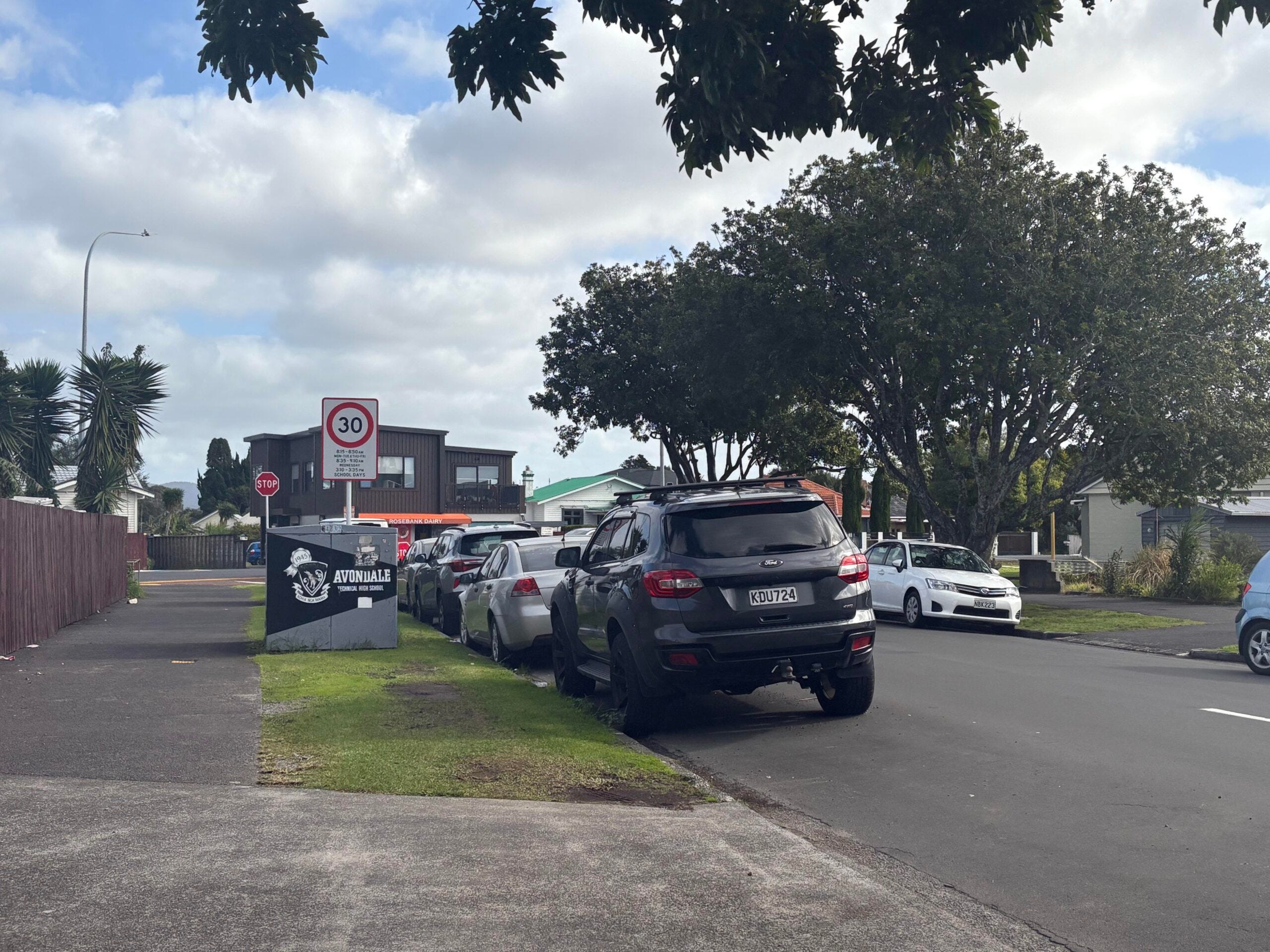
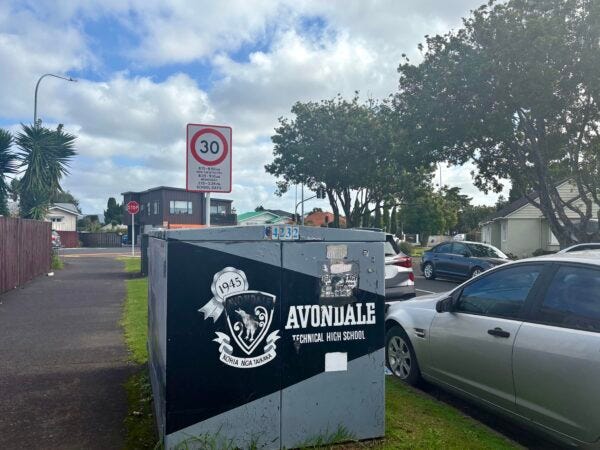
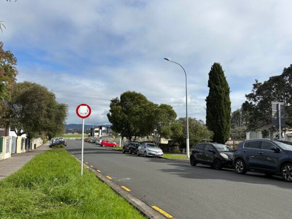
Last week I found myself in Avondale, where speed reversal signs were already being installed around Avondale Primary School in Road Safety Week no less. (The signs were still blanked out, but the National Speed Limit Register says the new speeds apply from last Thursday 15 May – but as of Monday 19 May, only one of the signs had been unveiled.)
As per AT's Speed Reversal Map Viewer, these are the 30km/h streets around Avondale Primary School that AT believes it must revert to 50km/h, with brief exceptions on school days only.
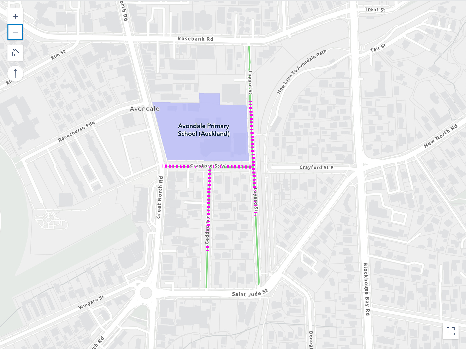
What's striking about this particular set of speed reversals "for school reasons" is that it incudes Layard St, which is the main access to Avondale Train Station. This detail isn't clear on AT's map above, so I've highlighted it below. I've also highlighting the fact that these streets are also an 'on-ramp' to the citywide cycle network, which gets you off-road to Westgate, the City, Mt Roskill, Onehunga, and more.
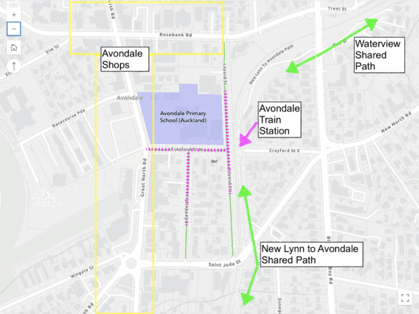
Why are these streets going back up? Presumably because AT thinks "school" was a reason for these speed reductions (we can't be sure, because the consultation material is no longer online). Either way, over 300 children attend this school, so that's a pretty big impact already.
But at least 1000 people a day also use these streets to get to Avondale Station, at a rough estimate based on the most recent available numbers. And the daily flow of people will be even higher when CRL opens next year.
So the biggest impact of AT's strict application of the speed rule "because of school" is on thousands of people moving around between the station and town centre. They'll now cross paths with drivers who've been given the official go-ahead – in the name of "productivity" – to drive at 50km/h on these streets.*
* Except in the following time slots. (Can you read this fine print at 30km/h, let alone 50km/h? No? Hold that thought).
Layard Street is also home to a medical centre and new apartments, as well as the school and train station. So the safer speeds in this tightly focused area play a broader local role in safety and quality of life.
Moreover, in 2022 this area got some physical traffic-calming as part of Eke Panuku's work to uplift Avondale and its growing local population. Crayford St West, which runs downhill past the school, got new planting and raised crossings – not just for school reasons, but explicitly "to improve the safety and street appeal of the connection from the train station to the town centre" and to "increase safety for people walking and cycling".
The people in question include children, of course, and on weekends as well as weekdays (there's a cool bike track inside the school grounds). But it also includes thousands of new residents within walking distance. Down on Great North Road, new housing and a community centre are coming to the long-empty 'Three Guys' site and apartment buildings are popping up around the racecourse. There's even more housing (by Kāinga Ora and Ockham) at the other end of the town centre.
This is big-picture stuff. This small pocket of safely walkable 30km/h streets is a key element of Avondale's redevelopment, and of maximising the value of CRL to reduce congestion on Auckland's roads.
And now AT is putting these streets back up to 50 km/h, thanks to their reading of the Speed Rule, because "school".
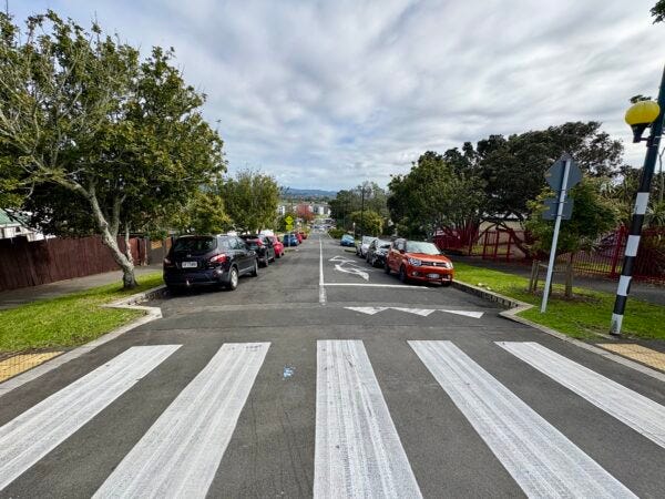
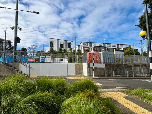
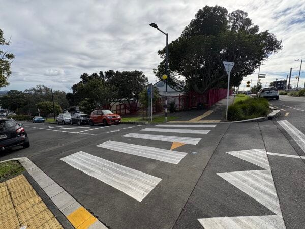
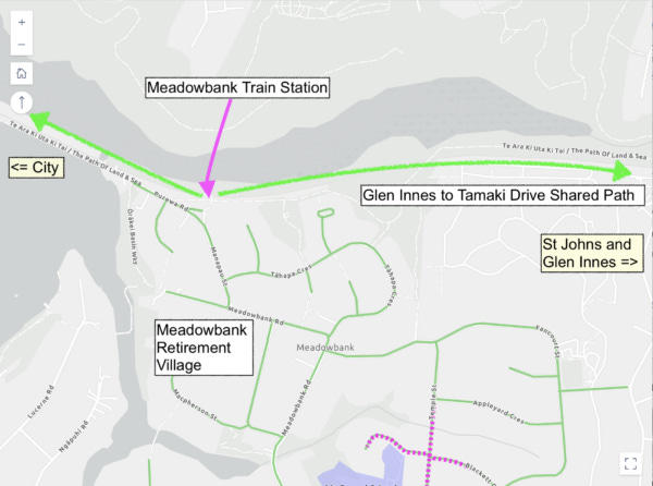
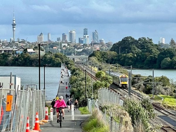
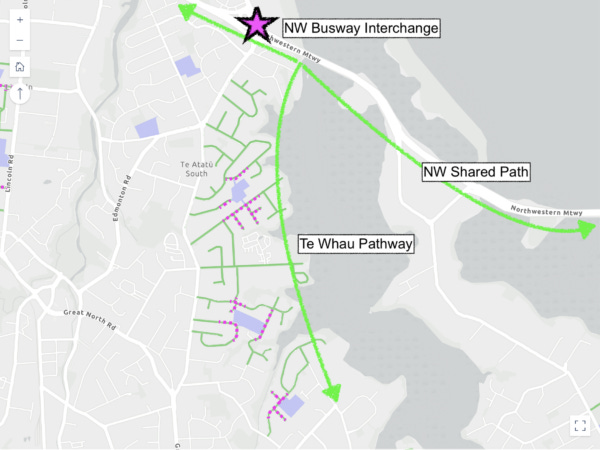
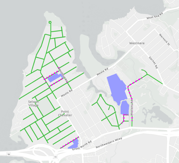
It's not just Homai and Avondale: let's add Meadowbank to the list of perverse outcomes from AT's speed reversals, with impacts across all modes of transport. Meadowbank Station sits within a quiet, walkable, bikeable, no-exit (for traffic) residential enclave – whose 30km/h streets are about to be raised by AT back to 50km/h, despite local disquiet.
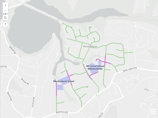
The purple patches are schools, but look what else is in this picture. A train station. A large retirement village. And what's that green path? Oh, just the biggest investment in cycling infrastructure in Auckland (so far).
Why is Auckland Transport raising speeds around major new bike infrastructure – oh and the NW Busway?
It's not just Avondale and Meadowbank where AT is rolling back the safe speeds that give safe access to public transport and long-distance bike network – which will have the effect of discouraging uptake, reducing the value of these investments and their decongestion effect.
Check out Te Atatū South, where Te Whau Pathway is currently taking shape and the NW Busway and WX express services are growing ridership by the day.
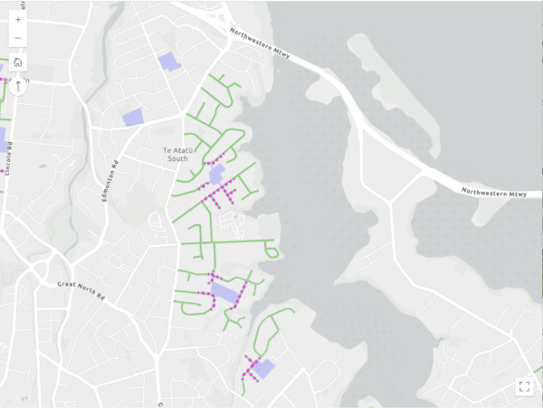
This area is full of schools, and it's also full of people who live within cooee of alternatives to driving: the Northwestern Cycleway, Te Whau Pathway , and the Te Atatū interchange for the brand new WX express buses. Raising speeds on these streets back to 50km/h will send people back into cars. Great move.
By the way, one of the purple patches on the map above – with a variable speed zone incoming – is Tirimoana School. The photo below came to us via social media and we have every reason to believe it's real.
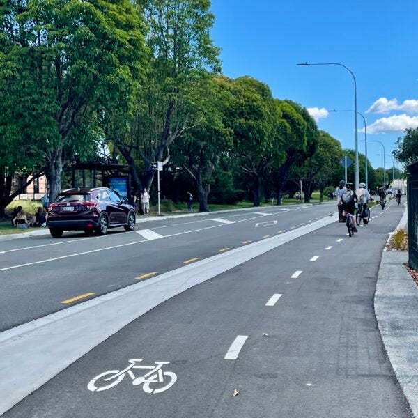
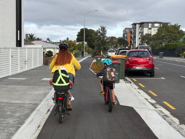
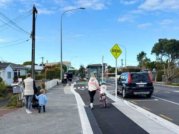
If you're looking for an even more high-profile examples of speed reversals that will actively undermine investment in alternative modes, check out Pt Chevalier. Long a high-achiever for active modes, its brand new cycleways along the main routes are now attracting even more people to go by bike, and growing local walking and bus use too.
In March, AT's automatic counter recorded an average 500 bike trips per day on Meola Rd – well on the way to the business case target of 700 bike trips a day in 2028 – plus over 700 walking and scooting trips per day. Note, this counter doesn't capture the trips at each end of Meola, including primary school travel, shopping trips, and commuters on Pt Chevalier Rd.
Everyday scenes like this are normal now. It looks like the renders.
But AT is set to roll back 30km/h limits across most of the short streets and cul-de-sacs of most of the peninsula. As a community appeal for keeping the 30km/h limits on the quiet local feeder streets puts it: raising speeds is "the equivalent of removing fences and lifeguards from around a brand new and highly popular public swimming pool."
But wait, there's more!
If you take a look at the Speed Reversal Viewer, you’re bound to find more examples like the above – and also, a whole lot of quiet self-contained neighbourhoods who have no idea their speeds are about to go back up (Kelston! Balmoral! and more). Because this is happening with zero consultation, and minimal publicity.
The point is that most 30km/h areas, the "reasons" for safer speeds – even if schools happened to be one of them – are an overlapping Venn diagram including residential streets, retirement villages, community requests , access to great new public transport options, and access to new cycling infrastructure. This is a whole transport system issue; and reversing safe speeds is self-harm on an institutional scale.
Is this what anyone wants? Is it even what the former Minister of Transport (and still Minister for Auckland) wanted when he rewrote the Speed Rule?
We've called the situation Kafkaesque, and the examples in this week's posts are just a fraction of the dangerous, disproportionate and downright silly impacts of AT sticking to its early – and increasingly lonely – understanding of the Speed Rule. Knowing that other cities have taken a more reasonable approach, there's no conceivable reason AT can't moderate its approach, with the Minister as needed, and with support from elected representatives
Bonus fine print: the illegibility of “variable” school speed signs
So, the safety figleaf in the Speed Rule was the introduction of "variable" 30km/h zones around schools. Leaving aside the fact that this is actually a safety downgrade, because it shrinks safe speeds back to a narrow window of time and space around school gates, and leaves children unprotected for the majority of their journeys to school...
...how does this look and work in practice? And how's AT going at rolling out these zones? Here are three examples, just from Avondale alone.
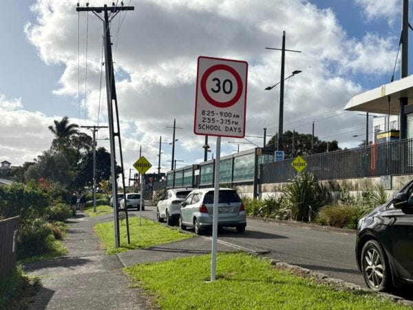
The fine print (1): Layard St
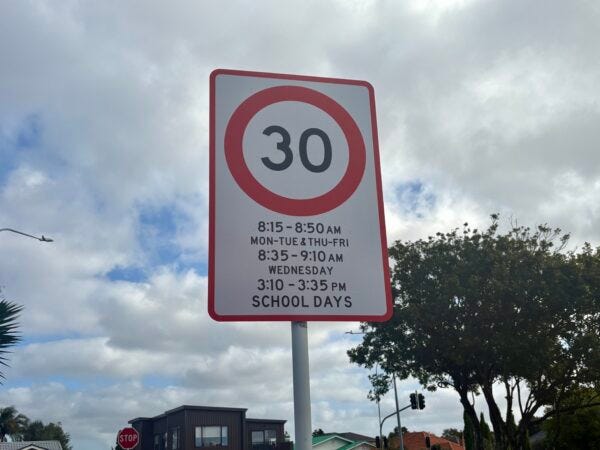
Remember the variable speed sign on Layard St outside Avondale Station. Can you recall the time slots when you must drop your speed from 50 km/h to 30km/h? (If you could even read them, that is.) They were:
8.25am - 9.00am
2.55pm - 3.15pm
SCHOOL DAYS
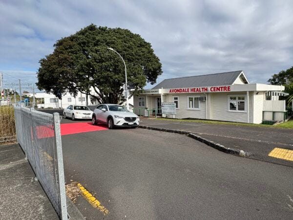
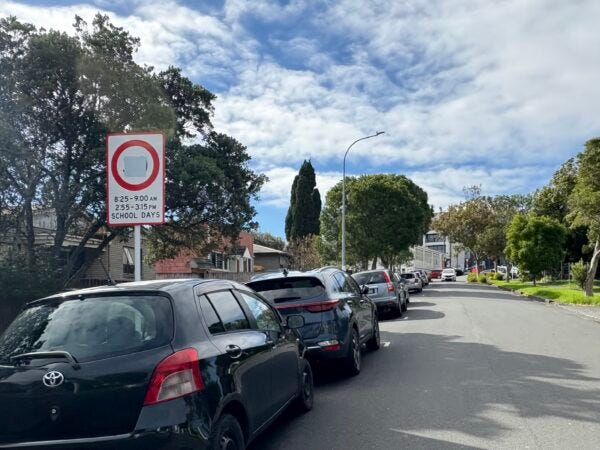
Now check out the signs for the 5-minute parking spots outside Avondale Primary School – photo below from Layard St; there are similar spots on Crayford St West.
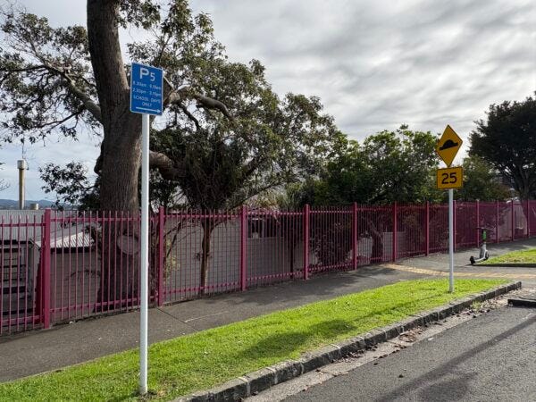
It's hard to read, but the 5-minute parking applies from:
8.30am - 9.15am
2.30pm - 3.15pm
SCHOOL DAYS ONLY
So if you're a kid who's getting dropped off a bit late, between 9am and 9.15am, or collected early, between 2.30pm and 2.55pm, you'll be doing so amidst drivers who've been told they can go 50km/h.
The fine print (2): Victor St
If you're still squinting at the small print on those P5 signs, you'll want to head to Specsavers before reading on. This is the safe speeds area for reversal around Avondale College, Avondale Intermediate and Rosebank School, which together have a combined roll of over 3700 children and young people.
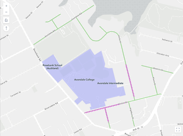
Here's a brand new sign outside Avondale College, operative as of Monday 19 May, on Victor St approaching Rosebank Road, as seen from about 20m away. Now imagine you're going 50 km/h. Can you read it?
Maybe you need to be a bit closer to make out the fine print. Say less than 10 metres. How about now? (At this point, longtime readers may be having flashbacks to 2015, when AT ran into trouble with a new design for street signage that didn't pass the readability test.)
Still struggling? Okay, here's how that sign looks when you're standing right underneath it.
Now a quick pop quiz, without thinking too hard: You're driving along Victor St. It's 9am on a Tuesday, You see this sign. How fast should you be going?
Wait, sorry, it's actually Wednesday. How fast should you be going now?
You may have other questions, such as: why is the sign telling you this after you've already driven past the school gate, and are already within 20m of Rosebank Road, a 50km/h street? Great question. You'd have to ask AT.
The fine print (3): Racecourse Parade
Funnily enough, the first signs I spotted in Avondale were on Racecourse Parade, a short cul-de-sac that isn't part of the existing 30km/h zone. Why does it have new signs? Because a section of Great North Road – the main shopping drag, and a busy bus route – is getting a variable 30km/h limit for short bursts, morning and afternoon, on school days. At all other times, it'll be 50km/h.
So, this quiet dead-end street has a shiny new sign, for people driving towards Great North Road (see below). According to the sign, you should drive at a stately 30km/h from 8.25 - 9.00am and 2.55 - 3.15pm on school days. The rest of the time, it's 50km/h (but watch out for the traffic-calming bump-outs ahead).
Even weirder, Racecourse Parade apparently now needs a shiny new 50km/h sign, to remind incoming drivers to speed back up once they've escaped the school bubble. And here it is: less than 100m from the end of this dead-end street.
The point is: just as with the safe speeds areas that were saved at the last minute, the process of printing these signs – let alone installing them – should have been a cue for everyone involved to stop and ask: wait, why are we actually doing this? Do we even have to?